
The Mexican Republic is mainly crossed by three mountain ranges: the Sierra Madre Occidental, the Sierra Madre Oriental, and the mountain chain that connects both, known as the Neo-Volcanic Cordillera, where some of the country’s most famous volcanoes rise, such as Popocatépetl, Iztaccíhuatl, and Pico de Orizaba (the tallest of them all and the focus of this getaway proposal).
Pico de Orizaba (also called Citlaltépetl or “Mountain of the Star” in the Nahuatl language) is a spectacular formation over 5,600 meters above sea level, located between the states of Puebla and Veracruz. Interestingly, although it bears the name of a picturesque town in Veracruz, most of its territory (designated as a Protected Natural Area and National Park since 1937) lies within the state of Puebla.
In fact, to embark on the adventure of reaching its summit (primarily between November and March), one of the most popular options is on the western face of the volcano, on the Puebla side, accessing it through the town of Tlachichuca—simple, yet beautifully framed by the magnificent silhouette of Pico de Orizaba.
At this point, we recommend hiring guides authorized by the National Commission of Natural Protected Areas. Traveling in 4x4 vehicles and following Civil Protection advisories regarding weather conditions, they can help you explore the National Park or prepare you to ascend to “the highest place in the country,” following safe routes and using the proper equipment to avoid unnecessary hardship and fully enjoy the experience.
The first stop is Piedra Grande refuge, at approximately 4,200 meters above sea level, where you can check that your backpack contains everything needed to conquer the summit of Pico de Orizaba: snow jacket, down jacket, windbreaker, water bottle, ice axe, trekking poles, helmet, headlamps, and crampons. In fact, this is a good place to take your first lesson on how to attach crampons to your boots and master the technique of walking and advancing through snow.
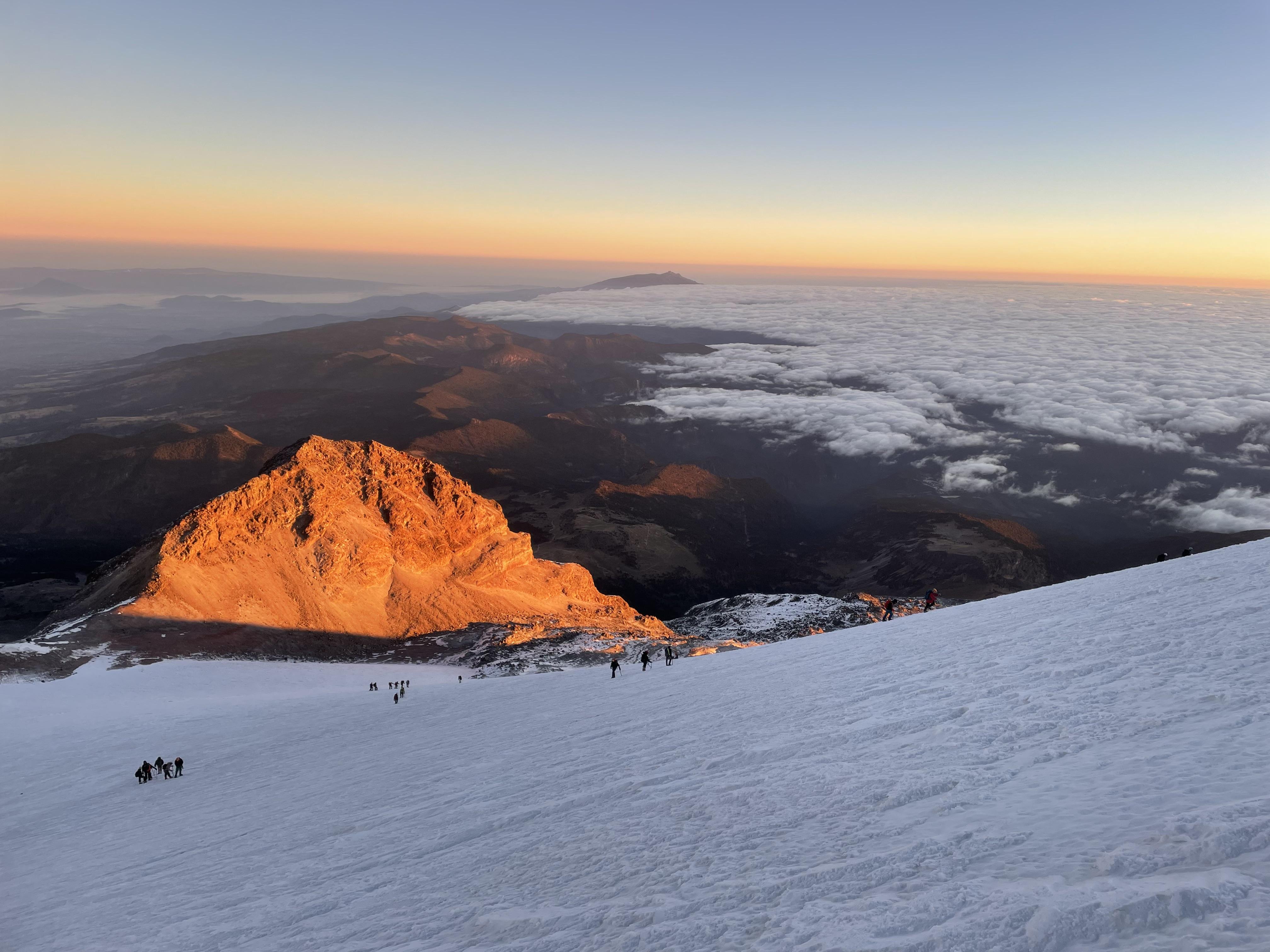
The journey continues along the Aqueduct Route, which leads to the Nidos area (the last shelters before beginning the final and most demanding ascent), passing through the Laberintos zone, and finally reaching the Jamapa Glacier.
If you are a beginner, this last stretch—from the refuge to the densest part of the glacier—can take between six and eight hours, which is why experts recommend starting this exciting and challenging mission around 1:00 a.m., so that when the sun rises, you are already very close to the summit, contemplating a simply spectacular landscape: all of Mexico at your feet! Fatigue and cold have not defeated you, and now you are one with nature, at 5,636 meters above sea level!
The town of Tlachichuca, where the official journey to conquer Pico de Orizaba begins, is located approximately three hours by car from Mexico City.
And receive exclusive information to travel through Mexico in style!